World-Outline Map

1.00

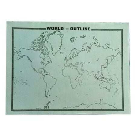
The world outline map displays the continents, the political boundaries of countries within those continents, and the lines of latitude and longitude. The printable map is a useful practice and learning aid for school children. The children can color the different countries, continents, and oceans and enhance their knowledge of world geography.

Free Delivery Over 199

Best Products 100% Tested

Fast Delivery 30 min - 3 Days

Cash on Delivery

14 People watching this product now!

Description

Related Products

Apsara Non Dust Eraser 60mmX17mmX11mm (1Pcs)

5.00
Add to cart

Apsara Non Dust Eraser 33mmX17mmX10mm (1Pcs)

3.00
Add to cart

Reynolds Gel Pen (Blue,Black,Green ,Red) 10Rs.

10.00

Select options
colour

Black, Blue, Green, Red

Classmate A4 Notebook – Single Line Regisrte(172Pages, 240Pages, 304Pages, 400 Pages)

50.00125.00

Select options
pages

172 pages, 240 pages, 304 pages, 400 pages